
 Roman remains
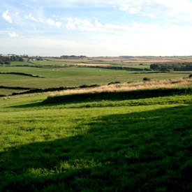
Hadrian’s Wall, stretching right across the North of England, continued west through Carlisle and along the Solway coastline to Bowness-on-Solway. Bowness was the location of the Roman fort “Maia” and everywhere you can see Roman stones in the local buildings along this area.
Visit Bowness to start or end the Hadrian's Wall Path National Trail, a long-distance footpath following the route of the wall right across to Wallsend, near Newcastle upon Tyne. Or take a short stroll through this pretty village and along the coast to walk in the foorsteps of the Romans.
West of Bowness, Roman fortifications continued all the way along the West Cumbrian coast to Ravenglass through a network of forts and milecastles. Visit Milefortlet 21 near Crosscannonby, just north of Maryport, a short stroll taking in fabulous views across the beach and the historic saltpans below.
 Salt pans
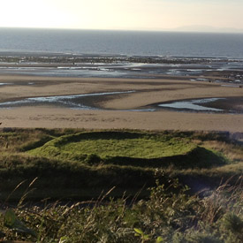
Salt making was historically a hugely important industry and was a very valuable resource- before refrigeration, salt was the main way that food could be kept from going bad. Virtually the whole West Cumbrian coastline was dotted with saltpans, enclosures where salt was obtained by processing sea water. The monks of Holme Cultram Abbey set up many salt pans on the coastline close to the Abbey. Place names such as “Saltcotes” give clues to where some of these activities took place.
Crosscannonby salt pans, near Milefortlet 21, are a good place to start if you want to see what they might have looked like in other parts of the Solway where few have survived. Find them on the B5300 road between Allondy and Maryport near the turn off for Crosscanonby.
 Kests, hedges and stoops
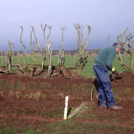
The Solway Plain’s longstanding economic role in agriculture has led to the creation of a distinctive array of historical features which can be spotted in lots of places as you walk, drive or cycle around the area. Look out for “kests” which are raised hedge banks, many of which have been in place for dozens if not hundreds of years and are rich in wildlife and habitats. In many places you can see stone gate “stoops” or posts, usually on either side of a gateway-traditional and longstanding features of the farming landscape.
 Clay dabbin buildings
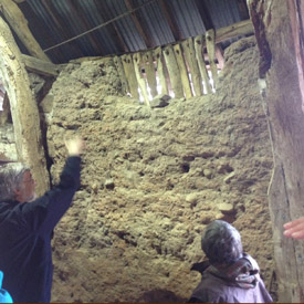
Clay dabbin is the name for a traditional building using earth and clay instead of stone or brick. Buildings like this were found in other parts of Britain but the Solway Plain is one of the only areas in the country where clay dabbin buildings still survive in number. The material used was normally a mixture of clay, silt, sand and gravel mixed with straw. This was layered on top of straw so the wall was made up of multiple layers of straw and clay mix. Often the walls and roof were built around a “cruck” (traditional wooden frame) Although similar to other areas of the country, the construction method used in this area was distinct to Cumbria.
There were about 1300 clay dabbin buildings on the Solway Plain before the First World War but a recent count has discovered that only around 300 remained in 2005. Some of these buildings date as far back as the 1500s.
This traditional building technique is under threat as few have the time or skills to maintain and restore these buildings. It is essential that we keep these skills alive for future generations, and for this reason, the Solway Wetlands Landscape Partnership runs a programme of Heritage Skills Training.
If you want to see some clay dabbin buildings form the outside, a good place to visit is the village of Burgh-by-Sands just a few miles west of Carlisle.


